Property Record
58 Worley Xrds, Jasper, GA 30143
NEARBY LISTINGS FOR SALE OR LEASE
-
-
View all Jasper listings for sale on LoopNet.com
Property Detail
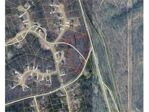
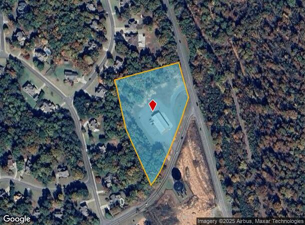
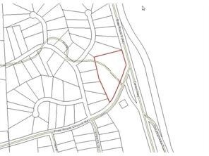
58 Worley Xrds
065-000-002-003
Wild Timber Sub
Policefirecivildefense
DIST4 LL156 5.129AC FIRESTATION
X
Pickens
13057C0070E
Georgia
0
5.13 AC
2025
Pickens County
050202
Atlanta
6,480 SF
Atlanta-Sandy Springs-Roswell, GA
DEMOGRAPHICS near 58 Worley Xrds
1 Mile
3 Mile
5 Mile
2024 Total Population
1,149
6,534
16,335
2029 Population
1,260
7,392
18,454
Pop Growth 2024-2029
+ 9.66%
+ 13.13%
+ 12.97%
Average Age
40
43
43
2024 Total Households
417
2,494
6,251
HH Growth 2024-2029
+ 9.35%
+ 13.47%
+ 12.99%
Median Household Inc
$94,196
$85,554
$76,212
Avg Household Size
2.70
2.60
2.60
2024 Avg HH Vehicles
2.00
2.00
2.00
Median Home Value
$252,648
$290,017
$291,418
Median Year Built
1992
1992
1994
Nearby Places
Map Layers
Map Styles
 Street
 Aerial
- Restaurants
- Banks
- Shops
- Fitness
- Groceries
SALE & LEASE HISTORY
LISTING DATE
SALE/LEASE

Sep 24, 2016
For Sale
Apr 11, 2017
For Sale
Nearby Properties
Address
Land Use
TOTAL SIZE
Lot Size
Zoning
Address
Land Use
TOTAL SIZE
Lot Size
Zoning
60,684 SF
5.42 AC
C-2
Address
Land Use
TOTAL SIZE
Lot Size
Zoning
29,236 SF
3.44 AC
HB
Address
Land Use
TOTAL SIZE
Lot Size
Zoning
213,868 SF
170.62 AC
HB
Address
Land Use
TOTAL SIZE
Lot Size
Zoning
13,532 SF
21.37 AC
HB
Address
Land Use
TOTAL SIZE
Lot Size
Zoning
4,000 SF
0.40 AC
I
Address
Land Use
TOTAL SIZE
Lot Size
Zoning
719.19 AC
AG
Address
Land Use
TOTAL SIZE
Lot Size
Zoning
6,655 SF
22 AC
HB
Address
Land Use
TOTAL SIZE
Lot Size
Zoning
743.09 AC
SR
Address
Land Use
TOTAL SIZE
Lot Size
Zoning
18,160 SF
4.46 AC
C-2
Address
Land Use
TOTAL SIZE
Lot Size
Zoning
5,130 SF
3.95 AC
HB
Address
Land Use
TOTAL SIZE
Lot Size
Zoning
11,470 SF
6 AC
HB
Address
Land Use
TOTAL SIZE
Lot Size
Zoning
30,000 SF
2.16 AC
LI
Address
Land Use
TOTAL SIZE
Lot Size
Zoning
6,000 SF
20.30 AC
C-2
Address
Land Use
TOTAL SIZE
Lot Size
Zoning
22,560 SF
10.29 AC
C-2
Address
Land Use
TOTAL SIZE
Lot Size
Zoning
134.55 AC
LI
Address
Land Use
TOTAL SIZE
Lot Size
Zoning
1,456 SF
308.12 AC
AG
Address
Land Use
TOTAL SIZE
Lot Size
Zoning
14,772 SF
2.08 AC
C-2
Address
Land Use
TOTAL SIZE
Lot Size
Zoning
45 AC
HB
Address
Land Use
TOTAL SIZE
Lot Size
Zoning
8,510 SF
8.50 AC
PUD
Address
Land Use
TOTAL SIZE
Lot Size
Zoning
960 SF
13 AC
I
Address
Land Use
TOTAL SIZE
Lot Size
Zoning
352 AC
AG
Address
Land Use
TOTAL SIZE
Lot Size
Zoning
12,000 SF
2.01 AC
HB
Address
Land Use
TOTAL SIZE
Lot Size
Zoning
15,200 SF
1.13 AC
C-2
Address
Land Use
TOTAL SIZE
Lot Size
Zoning
17,610 SF
3.46 AC
C-2
Address
Land Use
TOTAL SIZE
Lot Size
Zoning
6,264 SF
1.58 AC
C-2
Address
Land Use
TOTAL SIZE
Lot Size
Zoning
11,981 SF
4.37 AC
HB
Address
Land Use
TOTAL SIZE
Lot Size
Zoning
26,568 SF
2.50 AC
LI
Address
Land Use
TOTAL SIZE
Lot Size
Zoning
162.99 AC
HB
Address
Land Use
TOTAL SIZE
Lot Size
Zoning
16,135 SF
4.29 AC
C-2
Address
Land Use
TOTAL SIZE
Lot Size
Zoning
14,120 SF
2.62 AC
C-2
The World's #1 Commercial Real Estate Marketplace
Connect with us
© 2026 CoStar Group
The information above has been obtained from sources believed reliable. While we do not doubt its accuracy we have not verified it and make no guarantee, warranty or representation about it. It is your responsibility to independently confirm its accuracy and completeness. Any projections, opinions, assumptions, or estimates used are for example only and do not represent the current or future performance of the property. The value of this transaction to you depends on tax and other factors which should be evaluated by your tax, financial, and legal advisors. You and your advisors should conduct a careful, independent investigation of the property to determine to your satisfaction the suitability of the property for your needs.